 |
 |
||||||||||||
|
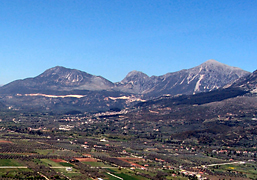
As GF poetically observed in Epitaph for a Squadron, the airfield lies in the vale of Decelia, below the massive limestone slopes of Mt Parnes to the West, with the Pentelikon rising to the East. Here Greek airmen first took flight in the 1930s, when the aerodrome known as Athens (Tatoi) was of some importance to international airlines. Today the airfield is occupied by the HAF as Dekelia-Tatoi Air Base, where the Athens Glider Club still retains flying rights. The airfield, TATOI LGTT, is at 38° 06' 32"N 23° 47' 02"E with an elevation of 785ft (239 metres) and the main runway, now as then, is aligned 0321, the winds of change notwithstanding. The airfield is some 10 miles or 16 km North of the centre of Athens. In the 1940s, Tatoi railway station was a mile or so to the East, on the line that still runs from Athens north to Thebes and on to Larisa and Thessaloniki. Perhaps 12 miles or 20 km to the West of the airfield is Elevsis (Eleusis), close by the bay of the same name and on the railway west to Corinth.
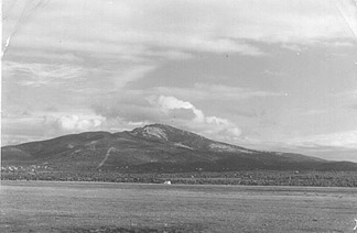
A fine shot across the empty grass landing area in 1940, looking East to the mass of the Pentelikon. Jim Fryatt held an identical print. In the middle distance, a dispersals tent. Beyond it, a line of telegraph poles evident in the original indicates a road and/or railway line. In the 1930s, maps of the area show both running to the immediate East of the aerodrome area, as do aerial photographs from 1944.
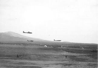
Eastwards across the airfield, towards the slopes of the Pentelikon. A slightly different view, from my father’s album. In both photographs, the hangars and workshops of the civil aerodrome are well out of shot, to the left and behind the camera position. From antiquity, the quarries of the Pentelikon yielded fine marble. The Parthenon was built from that stone: a presentation fragment lies in the foyer of our National Library here in Canberra, where I have spent many an hour teasing out the history of my father’s old Squadron.
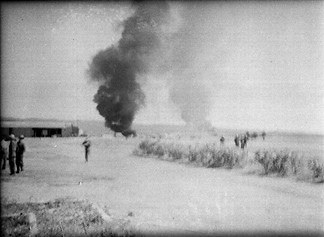
All but the end in Greece. The aerodrome after attack by the Luftwaffe, very likely 20 April 1941. From the positions of the figures it looks as though the action may be over. The Squadron was withdrawn the next day, via Scaramanga to Suda Bay and Heraklion, thanks mainly to 230 Squadron.
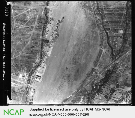
North to the top, the aerodrome photographed from 25,000ft in the early afternoon of 6 October 1944. The shadow of the photo recce aircraft (of 60 Squadron SAAF) is plainly shown, centre. German forces were already withdrawing from Greece: Athens itself was liberated on 14 October. The layout of the grass airfield much as it was known to the 211s in the Winter and Spring of 1940 and 1941. The extent of the permanent buildings, left, reflects the pre-war status of Tatoi as the civil airport of Athens, though the Germans may have added somewhat since 1941. The summer palace of the Greek Royal Family was at Tatoi proper, some 4 miles (8km) to the North by road, on the lower slopes of Mt Parnes. There HM George II King of the Hellenes was born in 1890. In World War II, the proximity of the Royal palace caused the RAF to adopt Menidi as the name of the airfield (yet often preferring “Menidi (Tatoi)”!). The village of Menidi with its railway station lay some 2 miles (4km) nearer Athens. Menidi today Paramythia then and now The modern boundaries of Greece had been set nearly thirty years before, by the 1913 Treaty of Bucharest. In settling the Second Balkan War of 1913, the Treaty included the ceding of Epirus (including Yannina and Paramythia) back to Greece. It may be that some confusion may have arisen for Lamb if his FAA charts were of pre World War I vintage, a not impossible case. In any event, contemporary maps of both German and British origin were in accord with the 1913 settlement and clearly show the border NW of Paramythia in its modern position. Apart from Wisdom’s 1942 Wings Over Olympus end-papers sketch-map, there are many formal examples, including: 1:100,000 Greece Sheet PARGA III H (MDR 356/7044 printed by 514 Fd Survey Coy RE 1943) Although impractical to reproduce all the maps in their entirety, part of the German Griechenland Nord sheet is shown on the Maps page. Published consistently pre-war and in the post-war accounts of, for example, Playfair, Richards, and the preceding RAF Narrative. Despite the obvious dangers and the political tensions within Greece, the welcome accorded to RAF men in Athens, Corfu, Paramythia, Agrinion and elsewhere remains bright in the memory of veterans. When the Germans overran Greece in 1941, there were reprisals.
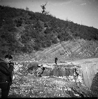
The blown culvert has been roughly repaired, left. When the Italians invaded across the Albanian border on 28 October 1940, Paramythia was briefly occupied, suffering damage to the village. The Greek counter-attack was prompt and effective. By 15 November 1940, Greece was free of Italian forces (RAF Narrative—Middle East Campaigns Vol VI: The Campaign in Greece). As the Italians rapidly withdrew deep into Albania, they also carried out some demolition of mountain road culverts, which were still being repaired as the 211 Squadron convoy journeyed North in February 1941.
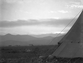
A bold shot in difficult light, the original scan from Gerry Martin’s negative is rich in detail. Along the near ground-line can be seen (left) what may be the radio vehicle, with several aerial masts close by. Next right stands a Blenheim, then a tent and a little distance behind, another hut. Further right, another large tent then more distantly a Blenheim, its large fin-flash just visible. Just glimpsed along the same ground-line and appearing between the tent guy-ropes, two men walk. The camp and flight line well dispersed, around March 1941.
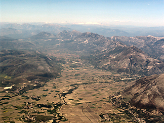
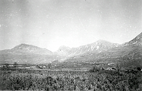
In Athens, Kyprianos Biris and some friends in General Aviation have an active interest in flying and finding old aerodromes in Greece. Kyp has an on-line album at the Hellas General Aviation page, with a number of his own photographs of Paramythia, some of which he has kindly agreed to share here. In writing to me, Kyp sent his warm greetings “to the legendary crewmen who flew in this place”. Well put, Kyp...and nice shots too...
Sources AWM Map collection, Greece Playfair ISO History Of The Second World War: The Mediterranean and Middle East “James Gordon” (Gordon-Finlayson) Epitaph For A Squadron (AH Stockwell 1965) www.211squadron.org © D Clark & others 1998—2025 |
||||||||||||
